
Long, straight and quiet: farm country, roadside shrines and open desert most of the way, then a run of curves in the hills before the road drops to the Bay of La Paz. La Paz is the capital of Baja California Sur and the big-city stop of the trip, with the ferry to the mainland at Pichilingue.
Route map
Map by Google. Google picks its own fastest line, which can differ from the road log. Open this route in Google Maps to navigate on your phone, and download it for offline use before you lose signal.
The mile log: Ciudad Constitución to La Paz
The original Baja Road Log entries, updated for 2026. Miles count from the junction with Highway 22 in Ciudad Constitución. Km posts count down from about km 210 here to around km 8 at the Dove of Peace monument in La Paz; the km column is estimated from those posts.
| Mile | Km post | What's there |
|---|---|---|
| 0.0 | ~km 210 | Ciudad Constitución at the junction with Highway 22 to Puerto San Carlos. |
| 0.4 | ~km 209 | Palacio Municipal (city hall of Comondú) on the left. |
| 1.1 | ~km 208 | Turn left for La Capilla de San Javier (0.5 mile), a big shrine shaped like a five-pointed star. |
| 1.4 | ~km 208 | Dirt road west (0.8 mile) to RV & Club Campestre La Pila. |
| 7.5 | ~km 198 | Villa Morelos, a farm town with cafes, small markets and a bus stop. |
| 9.9 | ~km 194 | Dirt road east to the El Ihuagil dam (24 km) and Misión San Luis Gonzaga (42 km). High clearance needed. |
| 21.4 | ~km 176 | A modern roadside shrine on the west side, built in 1993 in memory of lives lost in a 1973 farm water dispute. |
| 22.4 | ~km 174 | A roadside shrine to two children, surrounded by plants and keepsakes. |
| 32.5 | ~km 158 | Santa Rita, with cafes, a bus stop and a pretty church east of the highway. A dirt road west leads to Puerto Chale on Bahía Almejas. |
| 42.0 | ~km 142 | A colorful concrete and tile shrine to the Virgin of Guadalupe among the yuccas. |
| 59.4 | ~km 114 | Las Pocitas, a small town with a clinic, a bus stop, cafes and a llantera. |
| 68.0 | ~km 101 | El Cien, with cafes, stores and a fuel station reporting regular and diesel. It splits the run: if it is shut, there is no fuel for about 190 km between Ciudad Constitución and La Paz. About 100 km to La Paz from here; dangerous curves a few miles ahead. |
| 91.1 | ~km 63 | The well-known roadside shrine shaped like a white concrete cardón cactus. |
| 107.6 | ~km 37 | Pullout by a shrine with a view over La Paz. More curves ahead. |
| 115.5 | ~km 24 | Agricultural fruit-fly checkpoint. Southbound cars are usually waved through; northbound, expect to give up fresh fruit. |
| 118.2 | ~km 20 | Junction with the paved road to San Juan de la Costa, a phosphate mining town. |
| 120.3 | ~km 16 | El Centenario, with stores, markets, restaurants and topes. |
| 123.3 | ~km 12 | Junction with the paved road to La Paz airport. Highway 1 becomes a four-lane divided highway. |
| 124.6 | ~km 10 | The Dove of Peace monument, a bird in flight whose shape also makes a whale's tail. Headed straight for Los Cabos? Bear right for the Libramiento bypass around central La Paz. For downtown and the malecón, take the left fork along the coast, which becomes Calzada Abasolo and then Paseo Álvaro Obregón. |
| 125.3 | ~km 8 | Turn right for Los Cabos. Just past the intersection on the right is the Baja California Sur state tourism office. |
| 126.3 | ~km 7 | Fuel with diesel on the left. |
| 126.5 | ~km 6 | La Paz, at Calzada Abasolo and Blvd. Luis Donaldo Colosio, where Leg 11 begins. |
The last line of the old booklet's entry for La Paz was cut off in the paste-up.
- Fuel: one registered station near El Cien, about halfway. Leave Ciudad Constitución full.
- Curves: the road is straight for most of the way, then winds through the hills over the last 40 miles into La Paz.
- Ferry to the mainland: Baja Ferries sails from Pichilingue, north of La Paz, to Mazatlán and Topolobampo. Taking your vehicle to the mainland requires a temporary import permit (TIP), and everyone needs an FMM. A Banjercito module at the terminal is reported to issue TIPs; we could not confirm its hours.
- Inside the peninsula you still do not need a TIP.
Fuel
Ciudad Constitución (16 stations), one station near El Cien (regular and diesel reported) and more than 40 in La Paz, from Mexico's fuel registry. Find stations on Google Maps: El Cien, La Paz.
Where to stop and stay
Places below showed as operating on Google Maps when we checked on October 22, 2026, under the names they use now. Phone numbers and websites are the ones on their current listings. Call ahead before you count on a room or a campsite.
Tap a name to open it in Google Maps.
La Paz
- Hotel Calafia: hotel. +52 612 146 5500 · Website
- La Posada Hotel & Beach Club: hotel, formerly La Posada de Engelbert.
- Hotel Allende: hotel, formerly Hotel Mediterrané. +52 612 125 1195
- Hotel Lorimar: hotel. +52 612 125 3822 · Website
- Hotel Aquario's: hotel. +52 612 122 9266
- Perla La Paz, Tapestry Collection by Hilton: hotel, formerly Hotel Perla. +52 612 689 4500 · Website
- Hotel Plaza Real: hotel. +52 612 122 9333 · Website
- Hotel Miramar: hotel. +52 612 122 8885 · Website
- Pekín: hotel. +52 612 125 5335 · Website
- Hotel & Suites El Moro: hotel, formerly Club El Moro. +52 612 122 4084 · Website
- Hotel Araiza Palmira: hotel, formerly Araiza Inn Palmira. +52 800 026 5444 · Website
- The Westmarine Waterfront Hotel: hotel, formerly Hotel Marina. +52 612 121 6254
- La Concha Beach Hotel & Club: hotel, formerly La Concha Beach Resort & Condominiums. +52 612 121 6161 · Website
- Club Hotel Cantamar: hotel, formerly Club Cantamar Resort & Sports Centre. +52 612 122 1133 · Website
- Playa el Tecolote: RV park or campground.
New since the last booklet
- Campestre Maranatha: RV park at km 11, Chametla, on the way into La Paz.
- Sol RV Park & Tours: RV park, La Paz.
- Hotel Catedral La Paz: hotel.
- Hotel Indigo La Paz Puerta Cortés: hotel.
- Hotel Seven Crown: hotel on the malecón.
What changed from the old booklet
| Mile | Change |
|---|---|
| 1.4 | Campestre La Pila RV Park now listed as RV & Club Campestre La Pila. |
| 7.5 | Public phone dropped. |
| 68.0 | The booklet's "occasional diesel" replaced with the 2026 registry report. |
| 107.6 | Restaurant not confirmed; dropped. |
| 120.3 | Oasis Los Aripez RV Park could not be found. |
| 125.3 | Crowne Plaza Resort could not be found, and Marina Fidepaz was not confirmed under that name. |
| 125.9 | Club Casa Blanca RV Park could not be found. |
| 126.3 | El Cardón RV Park could not be found. |
Related guides
- TIP rules for Baja and the La Paz ferry
- Getting a TIP from Banjercito
- Mexican car insurance for long stays
- Gas stations in Baja
- The Baja Road Log: all 12 legs
Mexican auto insurance is required on federal highways, and longer stays need the right term. Get a quote online in minutes.
Frequently asked questions
How far is Ciudad Constitución from La Paz?
About 130 miles (209 km), or 2.25 to 3 hours.
Is there gas between Ciudad Constitución and La Paz?
One registered station near El Cien, about halfway, reported regular and diesel in October 2026. If it is closed, there is no fuel for about 190 km, so fill up in Ciudad Constitución.
Do I need a TIP for the La Paz ferry?
Yes, if you take your vehicle to mainland Mexico. A temporary import permit is not needed anywhere on the Baja peninsula, but the ferries to Mazatlán and Topolobampo will not load a foreign-plated vehicle without one, and everyone aboard needs an FMM.
Photo credits
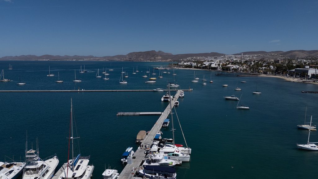
- Drone view of the La Paz malecon and bay. Photo: ProtoplasmaKid, CC BY-SA 4.0, via Wikimedia Commons
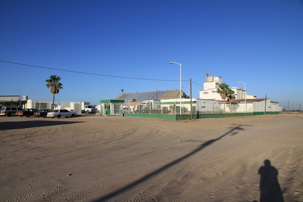
- Flour mill (harinera) in Ciudad Constitucion, center of the Santo Domingo farm valley. Photo: panza.rayada, CC BY-SA 3.0, via Wikimedia Commons
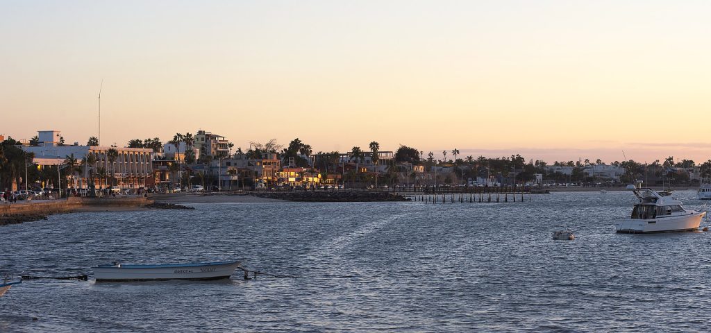
- La Paz malecon (waterfront promenade) at dusk. Photo: Carlos Valenzuela, CC BY-SA 4.0, via Wikimedia Commons
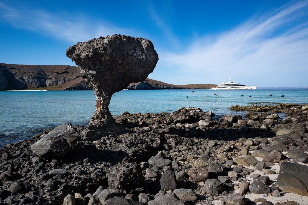
- El Hongo rock formation at Playa Balandra, north of La Paz. Photo: ProtoplasmaKid, CC BY-SA 4.0, via Wikimedia Commons
Checked October 22, 2026 against CAPUFE's 2026 toll schedule, the CRE/CNE fuel station registry, OpenStreetMap routing and Google Maps listings. Businesses open, close and change hands; confirm before you go.