

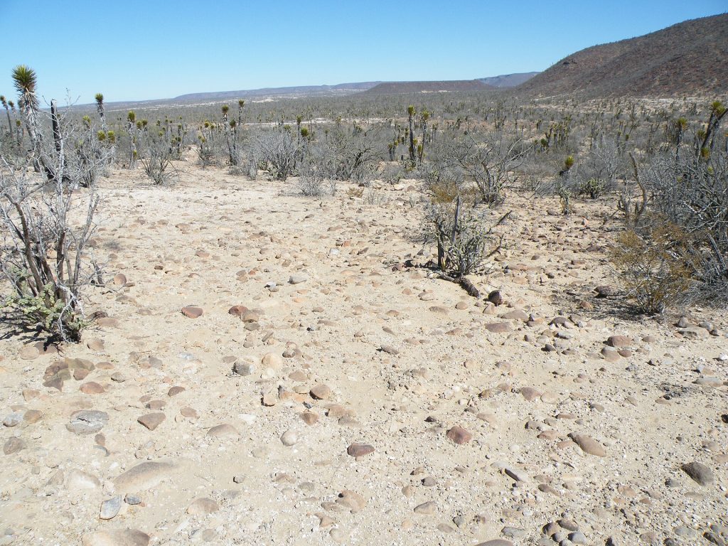
A straight, open run across the Vizcaíno Desert. The whale lagoon at Ojo de Liebre is a short detour at the start, Vizcaíno is the only real town, and the day ends in the date palms of San Ignacio. From here on the km posts count down toward Cabo.
Route map
Map by Google. Google picks its own fastest line, which can differ from the road log. Open this route in Google Maps to navigate on your phone, and download it for offline use before you lose signal.
The mile log: Guerrero Negro to San Ignacio
The original Baja Road Log entries, updated for 2026. Miles count from the Guerrero Negro junction on Highway 1. In Baja California Sur the km posts count down from about km 216 here to around km 73 at San Ignacio; the km column is estimated from those posts.
| Mile | Km post | What's there |
|---|---|---|
| 0.0 | ~km 216 | Guerrero Negro junction with Highway 1. In Baja California Sur the km posts count down as you head south. |
| 5.3 | ~km 207 | Turnoff to Laguna Ojo de Liebre (Scammon's Lagoon), the gray whale lagoon: a graded road of about 17 miles, OK for cars. Whale-watching season runs roughly January through March; check the current season and fees locally. |
| 16.4 | ~km 190 | Turnoff northeast on Mexico 18 to El Arco, an old gold and copper mining town, now close to a ghost town (26 miles on broken pavement). From El Arco a dirt road runs 23 miles east to Misión Santa Gertrudis, founded in 1752; high clearance recommended. The road from Ejido Mujica (below) is usually better. |
| 22.2 | ~km 180 | Ejido Lagunero, a small community with a grocery store. |
| 37.1 | km 154 | Ejido Mujica and a dirt road northeast to Misión Santa Gertrudis, about 37 miles and 1.25 hours through mountains and a cactus valley; OK for sturdy cars. The mission keeps its original freestanding bell tower, and local guides lead trips to nearby cave paintings. |
| 43.7 | ~km 146 | Ejido Vizcaíno, a farm town with stores, cafes, auto parts, a llantera, a pharmacy and fuel with diesel. A road west heads into the Vizcaíno Desert toward Bahía Tortugas and Malarrimo Beach: paved for about 20 miles, then dirt (4×4 recommended). |
| 51.2 | ~km 134 | Turnoff on the right for Emiliano Zapata, a dairy-farming ejido. |
| 59.7 | ~km 120 | Graded dirt road on the left to San Francisco de la Sierra and Cueva del Ratón, one of the easier rock-art caves to reach. Visits to the painted caves of the Sierra de San Francisco go through INAH (the museum in San Ignacio) and local guides; ask there about permits first. High clearance needed. |
| 71.8 | ~km 100 | Turnoff at the Crucero del Pacífico junction on a graded dirt road to Punta Abreojos (95 km) and the Pacific beaches. High clearance needed. Cardón and yucca line the highway. |
| 81.4 | ~km 85 | Several dangerous curves. |
| 83.8 | ~km 81 | Paved road on the left to the San Ignacio airstrip. |
| 86.2 | ~km 77 | Junction with the paved road to San Lino and Paredones, on the edge of San Ignacio. Rice & Beans Oasis (hotel, restaurant and RV park) is here. |
Whale season dates vary from year to year. Check with the lagoon operators before you plan around them.
- Fuel: 49 miles (78 km) from Guerrero Negro to Vizcaíno with no station in between. San Ignacio has one station, about 2 km off the highway in town.
- Signal: expect gaps across the Vizcaíno Desert. Keep offline maps.
- Km posts count down from here to Cabo San Lucas, with restarts at Santa Rosalía, Loreto and Ciudad Insurgentes.
- Time: if you crossed the state line between November and mid-March, you are now one hour ahead of Baja California.
Fuel
Stations from Mexico's registry: Guerrero Negro (4), Vizcaíno (3) and San Ignacio (1, in town about 2 km off the highway). Leave Guerrero Negro with a full tank. Find stations on Google Maps: Vizcaíno, San Ignacio.

Where to stop and stay
Places below showed as operating on Google Maps when we checked on October 22, 2026, under the names they use now. Phone numbers and websites are the ones on their current listings. Call ahead before you count on a room or a campsite.
Tap a name to open it in Google Maps.
Vizcaíno
- Hotel Olivia: hotel. +52 615 156 4524
- Hotel Kadekaman: hotel.
San Ignacio
- Hotel y Restaurant Rice & Beans Oasis: hotel. +52 615 154 0283 · Website
- Hotel Desert Inn: hotel, formerly Hotel La Pinta. +52 615 154 0300
- El Padrino Campground & Rooms: campground.
- Baja Oasis Hotel: hotel. +52 615 154 0111 · Website
New since the last booklet
- Paraíso Misional: RV park, San Ignacio.
- Ignacio Springs Bed & Breakfast: B&B, San Ignacio.
- Hotel La Huerta: hotel, San Ignacio.
- Camping y Ecotours Los Petates: campground, San Ignacio.
What changed from the old booklet
| Mile | Change |
|---|---|
| 5.3 | Gate hours and entrance fee not confirmed for 2026; dropped. |
| 16.4 | Restoration note dropped. |
| 37.1 | Fiesta date and camping note dropped. |
| 43.7 | Motels moved to the stays list. |
| 59.7 | Registration rules reworded; check current rules at the INAH museum. |
| 71.8 | Fisher's Cafe could not be confirmed as open. |
| 86.2 | Now listed as Hotel y Restaurant Rice & Beans Oasis. |

Related guides
- Gas stations in Baja
- The FMM tourist permit
- Cell phone service while driving in Mexico
- The Baja Road Log: all 12 legs
Highway inspections in Baja California Sur check for insurance valid in the state. Get a Mexican auto insurance quote online in minutes.
Frequently asked questions
How far is Guerrero Negro from San Ignacio?
About 92 miles (148 km) on Highway 1, or 1.75 to 2.5 hours across the Vizcaíno Desert.
When is whale-watching season at Guerrero Negro?
Gray whales are usually in Laguna Ojo de Liebre in winter, roughly January through March. Dates shift from year to year, so check with the operators before you go.
Where is gas after Guerrero Negro?
Vizcaíno, about 49 miles south, then San Ignacio, which has one station in town about 2 km off the highway.
Photo credits
- Vizcaino desert scrub with datilillo yuccas and mesas, the landscape Hwy 1 crosses. Photo: Amante Darmanin from Malta, CC BY 2.0, via Wikimedia Commons
- Salt evaporation works at Guerrero Negro, among the world's largest. Photo: Tomascastelazo, CC BY-SA 4.0, via Wikimedia Commons
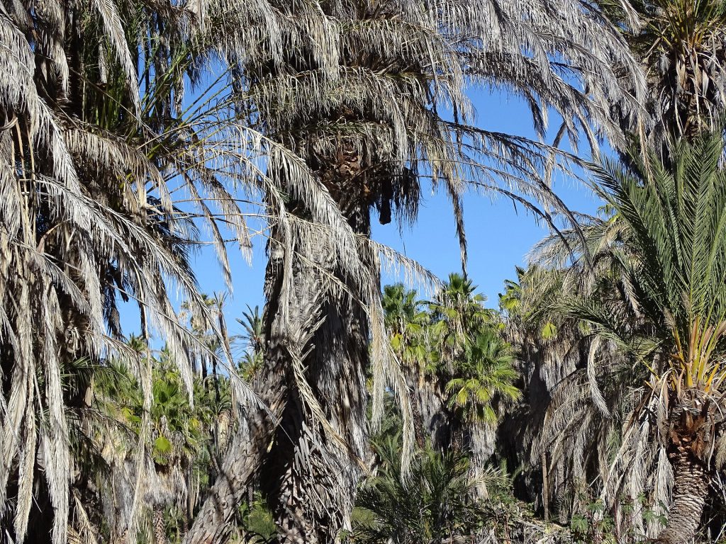
- Date palm grove at the San Ignacio oasis. Photo: Adam Jones from Kelowna, BC, Canada, CC BY-SA 2.0, via Wikimedia Commons
- Highway 1 junction at San Ignacio, BCS. Photo: Elnogalense, CC BY-SA 4.0, via Wikimedia Commons
Checked October 22, 2026 against CAPUFE's 2026 toll schedule, the CRE/CNE fuel station registry, OpenStreetMap routing and Google Maps listings. Businesses open, close and change hands; confirm before you go.