

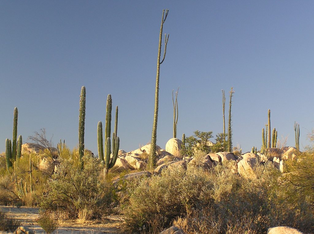
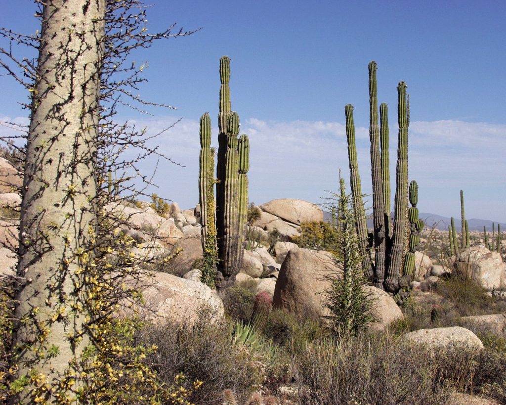
This is the long one, and the most beautiful. After El Rosario the road climbs into the Central Desert: cirios, giant cardones and the boulder gardens of Cataviña, with almost nothing in between. There is no fuel for 199 miles and no cell signal for most of the day. Start early, fill up in El Rosario, and plan to reach Guerrero Negro before dark.
- Fill up in El Rosario and do not count on Cataviña: no registered station, only barrel gas at a premium when someone is selling it.
- No cell signal for most of the stretch between El Rosario and Guerrero Negro. Download offline maps and tell someone your plan for the day.
- Do not drive this leg at night. Cattle stand on the road, and there is no shoulder.
- Coming from San Felipe on Highway 5? Fill up at Gonzaga Bay. From the Laguna Chapala junction it is about 150 km more to Villa Jesús María.
Route map
Map by Google. Google picks its own fastest line, which can differ from the road log. Open this route in Google Maps to navigate on your phone, and download it for offline use before you lose signal.
The mile log: San Quintín to Guerrero Negro
The original Baja Road Log entries, updated for 2026. Miles count from the San Quintín bridge. Km posts restart just south of San Quintín, again at the Bahía de los Ángeles junction, and count down in Baja California Sur; the km column is estimated from known posts (El Rosario around km 57 to 60, Cataviña around km 179, the junction around km 282).
| Mile | Km post | What's there |
|---|---|---|
| 0.0 | ~km 0 | The San Quintín bridge (Puente San Quintín). |
| 2.1 | ~km 1 | Lázaro Cárdenas, with Hotel Real del Cora and a military base. Just past the base, a 9-mile dirt road runs west past farms and volcanic cones to the oyster farms on Bahía Falsa. |
| 4.4 | ~km 5 | Graded road west (3 miles) to the Old Mill Hotel (Molino Viejo) and Don Eddie's Landing on Bahía San Quintín. |
| 6.9 | ~km 9 | The highway turns inland over a bridge. Follow the El Rosario / Guerrero Negro signs. |
| 10.5 | ~km 15 | Rough paved road west to Hotel Misión Santa María, and a dirt road to Cielito Lindo (motel and RV park, 2.5 miles) on Bahía Santa María. |
| 12.5 | ~km 18 | Junction with the old Santa María road back to Hotel Misión Santa María and Cielito Lindo. |
| 13.5 | ~km 20 | Turnoff west to El Pabellón RV Park (1 mile) on the beach. |
| 18.9 | ~km 28 | Turnoff to Playa del Socorro, with beach camping (0.5 mile). |
| 30.0 | ~km 46 | The road turns inland and you lose sight of the Pacific. |
| 36.2 | ~km 56 | The highway drops through a stark canyon of sedimentary rock where important fossil bones have been found. Watch the tight curves. |
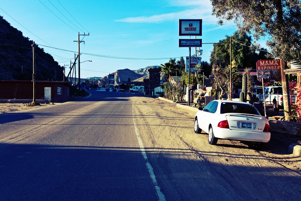
| 38.4 | ~km 60 | El Rosario, at the fuel station. Mamá Espinoza's restaurant, Doña Anita's place and an old favorite of this booklet, is still open. Fill up here: this is the last station for 199 miles (320 km). |
| 39.0 | ~km 61 | Delegación office (local government and police). |
| 39.2 | ~km 61 | Dirt road on the left, about 500 yards, to the first site of Misión de Nuestra Señora del Rosario de Viñadaco. |
| 43.0 | ~km 67 | Bridge over the broad Arroyo del Rosario. From here the desert takes over, with more than a hundred kinds of cactus and desert plants, many found nowhere else. |
| 48.0 | ~km 75 | The first cirios (boojum trees) appear: tall, tapering trunks like upside-down carrots, found almost nowhere else in the world. Tight curves ahead. |
| 54.1 | ~km 85 | Unsigned rough dirt road, 40 miles to Punta San Carlos, a surf and windsurf spot. |
| 69.2 | ~km 109 | Rancho El Descanso. Ranches start to appear from here on; watch for cattle on and across the road. |
| 77.0 | ~km 122 | Rancho El Progreso and the turnoff to the adobe ruins of Misión San Fernando de Velicatá, the only Franciscan mission in Baja California, founded in 1769 by Fray Junípero Serra. The 3-mile drive takes about 25 minutes and is OK for sturdy passenger cars. |
| 78.1 | ~km 124 | Rancho Santa Cecilia. A ranch sign on the highway means a working ranch with people living there. |
| 83.7 | ~km 133 | Dirt road on the right to the fishing village of Puerto Santa Catarina (33 km). |
| 91.4 | ~km 145 | San Agustín. |
| 93.6 | ~km 149 | Turnoff east on a graded road to El Mármol (15 km), an onyx quarry abandoned in the late 1950s. Chunks of onyx litter the ground, along with open shafts, an old cemetery and a schoolhouse built of onyx. Watch your step around the shafts. |
| 103.0 | ~km 164 | Las Vírgenes boulder field, a protected natural area. On the west side, a shrine to the Virgin of Guadalupe is painted on a big boulder. |
| 105.2 | ~km 167 | Dirt road to Faro San José (95 km). |
| 110.0 | km 176 | Turnoff on the left for the Cataviña cave paintings, made by the Cochimí people. Park near the riverbed, walk about 70 yards south to the trail and climb five minutes to the cave; the painted figures are on the ceiling. |
| 110.5 | ~km 176 | Blue fan palms in the Arroyo de Cataviñacita on the left, a sign of water in the desert. |
| 112.2 | ~km 179 | Cataviña, set among giant boulders, with small cafes, a llantera and Hotel Misión Cataviña. There is no fuel station. People sell gas from barrels here at a premium, and the quality is a gamble. No cell signal. |
| 113.1 | ~km 180 | Paved road (0.7 mile) to Rancho Santa Inés, with a small restaurant and camping. From here a rough 14-mile track (4×4 or high clearance) leads toward the ruins of Misión Santa María de los Ángeles, the Jesuit mission founded in 1767. Expect to hike the last mile. |
| 119.6 | ~km 190 | Rancho San Ignacito. A small monument on the west side marks where the north and south crews met to finish the Transpeninsular Highway in 1973. |
| 122.2 | ~km 195 | Rancho San Martín. |
| 130.0 | ~km 207 | El Pedregoso, a mountain of piled boulders that guided early travelers. |
| 144.9 | ~km 231 | Turnoff on a dirt road to Calamajué (60 km) and Bahía San Luis Gonzaga (55 km) on the Sea of Cortez. For Gonzaga, the paved Highway 5 junction just ahead is the better road. |
| 145.8 | ~km 233 | Rancho Nueva Chapala and Laguna Chapala, a wide dry lake bed. Around here Highway 5 from Gonzaga Bay and San Felipe joins Highway 1, paved all the way since the last edition. |
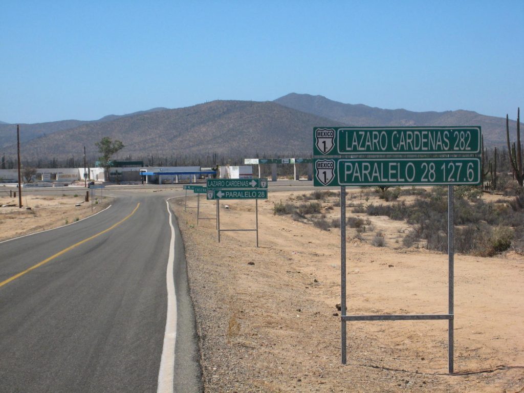
| 175.1 | km 282 | Parador Punta Prieta and the junction with Highway 12 to Bahía de los Ángeles, 68 km (42 miles) east (see Side trips). No fuel at the junction. Bahía de los Ángeles has fuel, but it is a long detour. Km posts restart at 0 here. |
| 183.4 | ~km 13 | Punta Prieta, with cafes, a grocery, a llantera and an airstrip. |
| 190.4 | ~km 25 | The highway climbs steeply, with a glimpse of the Pacific from the top. |
| 198.6 | ~km 38 | Turnoff west on a washboard road to Santa Rosalillita (15 km), a fishing village with a surf break. Sturdy vehicles only. |
| 206.4 | ~km 50 | Rosarito (the small desert Rosarito, not the beach town), with limited services. Signed turnoffs east lead to Misión San Borja (36 km), founded in 1762 and finished in 1801, one of the few stone missions still standing. High clearance needed; about 2 hours. |
| 223.1 | ~km 77 | Living fence posts made of datilillo along the road. |
| 232.5 | ~km 92 | Villa Jesús María, with a fuel station (with diesel), cafes and a mechanic. First fuel since El Rosario. A paved road west goes to Ejido Morelos and Laguna Manuela. |
| 250.1 | ~km 121 | Road to the Guerrero Negro airport, the dunes and Playa Don Miguelito. |
| 252.1 | ~km 220 | The 28th parallel: the giant eagle monument on the line between Baja California and Baja California Sur, inside a military base. The Halfway Inn is nearby. From early November to mid-March, set your clock forward one hour; the rest of the year there is no change. |
| 252.6 | ~km 219 | Agricultural inspection: staff spray the undercarriage and may ask about fresh fruit and vegetables. Travelers report a small fee, about 20 to 40 pesos, so keep small peso bills handy. Have your FMM ready. |
| 254.0 | ~km 217 | Junction: bear right for Guerrero Negro, about 2 miles west, with hotels, restaurants, fuel with diesel and full services. |
One line in the old booklet was pasted over and cannot be read; it is left out. Emergency phones the old booklet listed at ranches were not confirmed and have been left off.
- Fuel gap: El Rosario to Villa Jesús María, 199 miles (320 km), no registered station (Mexico's fuel registry, October 2026).
- Cell signal: none for most of the day between El Rosario and Guerrero Negro.
- Checkpoints: military checkpoints are commonly reported around Cataviña and El Tomatal, north of Villa Jesús María. Locations move.
- State line: agricultural fumigation and a small fee travelers report at 20 to 40 pesos. The clock goes forward one hour from early November to mid-March.
- Road: narrow two-lane highway with no shoulders, cattle and tight curves in the hills. Daylight only.
Fuel
This leg has the longest gap on the peninsula. Stations, from Mexico's registry: El Rosario (1, with diesel), then nothing on the highway for 199 miles until Villa Jesús María (1, with diesel) and Guerrero Negro (4). Bahía de los Ángeles has one or two stations, but it is a 68 km detour each way. Fill up in El Rosario and carry water. Find stations on Google Maps: El Rosario, Villa Jesús María, Guerrero Negro.
Where to stop and stay
Places below showed as operating on Google Maps when we checked on October 22, 2026, under the names they use now. Phone numbers and websites are the ones on their current listings. Call ahead before you count on a room or a campsite.
Tap a name to open it in Google Maps.
El Rosario
- Mamá Espinoza Restaurante: restaurant. +52 616 165 8770 · Website
Cataviña
- Hotel Mision Catavina: hotel, formerly Hotel La Pinta.
- Rancho Santa Inés: restaurant. +52 646 295 3716
Guerrero Negro
- The Halfway Inn: hotel, formerly Hotel La Pinta. +52 615 157 1305 · Website
- La Posada De Don Vicente: hotel, formerly Motel Posada de San Vicente. +52 615 157 0288
- Restaurante Malarrimo Hotel & RV Parking: RV park or campground. +52 615 157 0100 · Website
- Hotel San Jose: hotel.
- Hotel San Ignacio: hotel. +52 615 157 0270
- Hotel El Morro: hotel. +52 615 157 0414
- Dunas Motel: motel. Website
- Casa Laguna, Bed & Breakfast: hotel. +52 615 157 0261
New since the last booklet
- BajaCactus: motel, El Rosario.
- Hotel TerraSal: hotel, Guerrero Negro.
- Hotel Los Caracoles: hotel, Guerrero Negro.
- Hotel Alma Viajera: hotel, Guerrero Negro.
- Laguna Ojo de Liebre Campground: campground at the whale lagoon south of Guerrero Negro.
What changed from the old booklet
| Mile | Change |
|---|---|
| 2.1 | Motel Romo not confirmed (a profile shows it temporarily closed); removed. |
| 4.4 | Old Mill Village RV Park is no longer listed separately. |
| 6.2 | San Carlos Motel and the Old Pier restaurant could not be found. |
| 10.5 | Hotel La Pinta San Quintín is now Hotel Misión Santa María (same phone number). |
| 12.5 | La Pinta name updated. |
| 18.4 | Rancho El Socorrito could not be confirmed and was removed. |
| 22.1 | Valle Tranquilo RV Park could not be found. |
| 38.4 | Doña Anita's donation appeal and old phone were removed. The 24-hour claim was dropped. |
| 69.2 | Cafe and emergency phone not confirmed; dropped. |
| 77.0 | Emergency phone dropped. |
| 91.4 | Bus stop and trailer park not confirmed; dropped. |
| 93.9 | Lonchería Sonora could not be found. |
| 103.0 | Graffiti note dropped. |
| 112.2 | Hotel La Pinta is now Hotel Misión Cataviña. Motel Cabañas Linda could not be found. The old part-time gas sale is gone; there is no registered station. |
| 113.1 | Cabañas not confirmed; dropped. |
| 122.2 | Cafe and emergency phone not confirmed; dropped. |
| 144.9 | Added the Highway 5 pointer. |
| 145.8 | Added: Highway 5 junction (paved). |
| 175.1 | The closed Pemex is gone; no registered station within 30 km. |
| 183.4 | Emergency phone dropped. |
| 206.4 | Restoration note dropped. |
| 232.5 | Pemex renamed to fuel station (brand not confirmed). |
| 252.1 | Hotel La Pinta is now The Halfway Inn (same phone). La Espinita restaurant could not be found, and the Benito Juárez trailer park was not confirmed. The time change is now winter only. |
| 252.6 | The old FMT is now the FMM. Fee added from traveler reports. |
| 254.0 | Pemex renamed to fuel. |
Related guides
- Gas stations in Baja
- Driving to Bahía de los Ángeles
- Green Angels roadside assistance
- Military checkpoints in Mexico
- Cell phone service while driving in Mexico
- The Baja Road Log: all 12 legs
Mexican auto insurance is required on Highway 1. Get a quote online in minutes and pick the exact days you will be in Mexico.
Frequently asked questions
Is there gas in Cataviña?
No registered station. Mexico's fuel registry shows none within 25 km of Cataviña in October 2026, and the old Pemex is closed. People sometimes sell gas from barrels at a premium. Fill up in El Rosario.
How far is El Rosario to Guerrero Negro without gas?
The gap is between El Rosario and Villa Jesús María, about 199 miles (320 km). Guerrero Negro is about 20 miles past Villa Jesús María.
Is there cell service in Cataviña?
No. Expect no signal for most of the stretch between El Rosario and Guerrero Negro. Download offline maps before you leave.
What happens at the Baja California Sur state line?
Southbound cars stop at an agricultural inspection near the eagle monument. Staff spray the undercarriage, may ask about fresh produce, and travelers report a small fee of about 20 to 40 pesos. From early November to mid-March, Baja California Sur is one hour ahead.
Photo credits
- Granite boulders and cactus in the Catavina boulder field. Photo: Chrislorenz9, CC BY-SA 4.0, via Wikimedia Commons
- El Rosario seen from Hwy 1, looking north; last town before the long Catavina stretch. Photo: Ll1324, CC0, via Wikimedia Commons
- Highway 12 at Parador Punta Prieta, the turnoff from Hwy 1 to Bahia de los Angeles. Photo: Cdw1952 (Wikipedia user), CC BY-SA 3.0, via Wikimedia Commons
- Cardon cactus desert in the Catavina region, central Baja California. Photo: Tomas Castelazo, CC BY-SA 2.5, via Wikimedia Commons
Checked October 22, 2026 against CAPUFE's 2026 toll schedule, the CRE/CNE fuel station registry, OpenStreetMap routing and Google Maps listings. Businesses open, close and change hands; confirm before you go.