
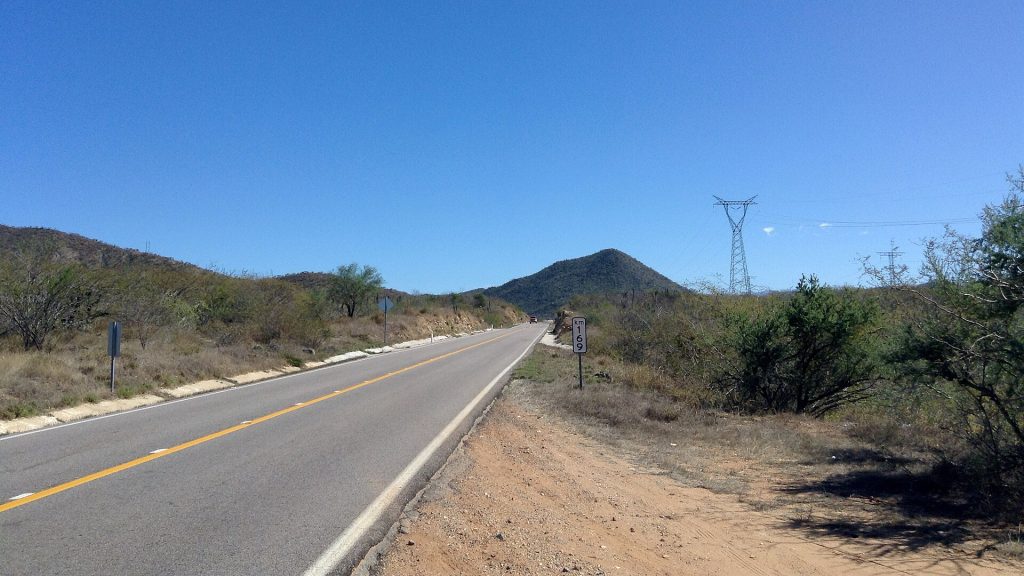
Two ways to finish the trip. The classic road log takes Highway 1 over the mountains through the old mining towns of El Triunfo and San Antonio, down to the East Cape at Los Barriles and on to San José del Cabo. Highway 19, now four lanes and toll-free, runs down the Pacific side through Todos Santos and is the quicker way to Cabo San Lucas.
Route map
Map by Google. Google picks its own fastest line, which can differ from the road log. Open this route in Google Maps to navigate on your phone, and download it for offline use before you lose signal.
The mile log: La Paz to San José del Cabo
The original Baja Road Log entries for Highway 1, updated for 2026. Miles count from Calzada Abasolo and Blvd. Colosio in La Paz. Km posts count down from about km 200 (they start some 15 km past the Dove of Peace) to around km 30 at San José del Cabo; the km column is estimated from known posts (Highway 19 junction at km 185).
| Mile | Km post | What's there |
|---|---|---|
| 0.0 | ~km 215 | Leave La Paz at Calzada Abasolo and Blvd. Luis Donaldo Colosio. Follow the Cabo signs to Calzada Forjadores and Highway 1. |
| 7.8 | ~km 202 | Propane (L.P. gas) station on the east side. |
| 14.8 | ~km 191 | San Pedro, a small town with stores, cafes and a fuel station. Watch for topes. |
| 18.6 | km 185 | Junction with Highway 19, now four lanes and toll-free, down the Pacific side through Todos Santos to Cabo San Lucas: the faster way if Cabo San Lucas is where you are headed. Highway 1 continues over the mountains by El Triunfo, San Bartolo, the East Cape, Santiago and San José del Cabo. |
| 28.8 | ~km 169 | Sharp curves. |
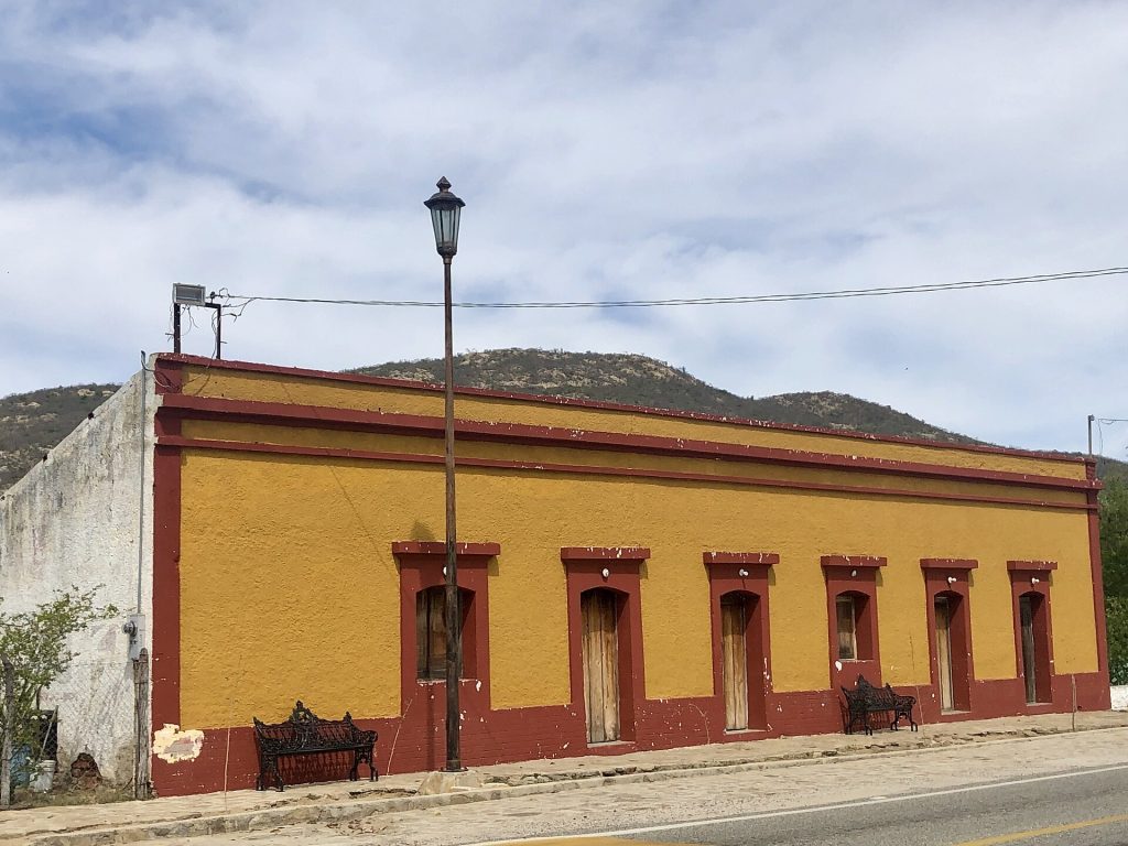
| 31.6 | ~km 164 | El Triunfo, an old gold and silver mining town that was once the largest settlement in the south. Its tall brick smelter chimney dates from the 1860s; the mines closed in the early 1900s. Turn right after the church at the north end of town to see the old smelter. Watch for topes. |
| 36.2 | ~km 157 | San Antonio, a farm town in a deep arroyo, with a cafe, a few stores and a fuel station (no diesel reported). For the next three miles the road follows a ridge with tight curves; watch for livestock. |
| 36.9 | ~km 156 | Mirador de Molinero viewpoint on the left. Blind curves. |
| 44.2 | ~km 144 | Rancho Verde RV Haven, on a large ranch in the hills. |
| 52.8 | ~km 130 | San Bartolo, a small town in a green arroyo where mangos, avocados and citrus are sold at roadside stands and cafes. |
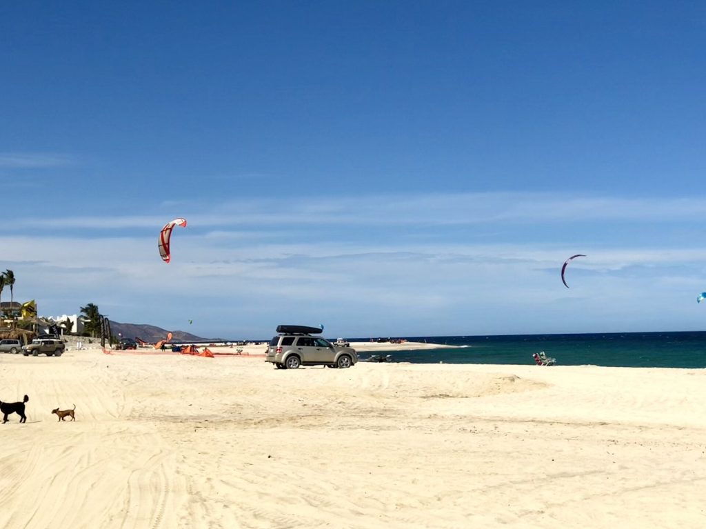
| 63.8 | ~km 112 | Junction with the road into Los Barriles on Bahía de las Palmas, with Hotel Playa del Sol, Hotel Palmas de Cortez, Los Barriles Hotel and Martín Verdugo's Beach Club. A dirt road north along the coast leads to Hotel Punta Pescadero Paradise. |
| 66.4 | ~km 108 | Entrance to Rancho Buena Vista (0.5 mile). |
| 67.1 | ~km 107 | Entrance to Buena Vista Oceanfront & Hot Springs Resort (0.3 mile). |
| 74.3 | ~km 95 | Junction with the paved road to La Ribera (8 miles), with a market, a pharmacy, a clinic and stores. From La Ribera the coastal road runs south to Cabo Pulmo National Park (17 miles) and Los Frailes (22 miles) and on to San José del Cabo. Only the first stretch is paved; the rest is washboard and sand. Check conditions after rain. |
| 79.3 | ~km 87 | Junction with the paved road to Santiago (1.5 miles), a pretty town with shops and restaurants. A dirt road runs about 6.5 miles on to Agua Caliente and hot springs in a canyon. |
| 81.2 | ~km 84 | A large sphere marks the Tropic of Cancer. |
| 87.5 | ~km 74 | Junction with the paved road to Miraflores (3 km), known for leather goods. |
| 103.5 | ~km 48 | Santa Anita, a small farm community. |
| 105.1 | ~km 46 | Junction with the road to Los Cabos International Airport. Highway 1 becomes a four-lane divided highway, and the Los Cabos toll road (1D) to Cabo San Lucas starts near the airport (118 pesos). Drivers reported potholes between the airport and San José del Cabo in October 2026. |
| 109.9 | ~km 38 | Turnoffs to Santa Rosa. |
| 111.6 | ~km 35 | At the light, bear left for San José Centro. Pass the fuel station and turn left on Calle Zaragoza into downtown San José del Cabo. |
The old booklet's Highway 19 log (Cabo San Lucas to La Paz) is summarized in its own section below.
- Highway 19 or Highway 1? Highway 19 (about 98 miles to Cabo San Lucas) is faster and four lanes. Highway 1 (about 115 miles to San José del Cabo) is slower and curvier, through mountain towns and the East Cape beaches.
- Fuel on Highway 1: San Pedro, San Antonio (no diesel reported), Los Barriles (2), Miraflores and San José del Cabo. On Highway 19: San Pedro, Todos Santos (3), El Pescadero (1) and Cabo San Lucas, with gaps of about 58 km.
- Road: tight curves and livestock between El Triunfo and San Antonio. Potholes were reported near the Los Cabos airport in October 2026.
- Tolls: none until the Los Cabos toll road (airport to Cabo San Lucas 118 pesos, San José del Cabo to Cabo San Lucas 93 pesos).
The Highway 19 alternative: Todos Santos and the Pacific side
Highway 19 leaves Highway 1 at the junction near San Pedro (around km 185) and runs south to Todos Santos, about 51 miles from La Paz, then another 47 miles past El Pescadero and Cerritos Beach to Cabo San Lucas. It is four lanes and toll-free, and at about 158 km it is the shorter way to Cabo San Lucas. Todos Santos sits right on the Tropic of Cancer and makes a good lunch stop. The old booklet logged this road northbound from Cabo San Lucas; the beaches it listed (Playa Migriño, Los Cerritos, San Pedrito) are still there.
Fuel
Highway 1 east: San Pedro (1), San Antonio (1, no diesel reported), Los Barriles (2), Miraflores (1) and San José del Cabo (29). Highway 19: Todos Santos (3), El Pescadero (1) and Cabo San Lucas (27). From Mexico's fuel registry, October 2026. Find stations on Google Maps: Los Barriles, Todos Santos, San José del Cabo.
Where to stop and stay
Places below showed as operating on Google Maps when we checked on October 22, 2026, under the names they use now. Phone numbers and websites are the ones on their current listings. Call ahead before you count on a room or a campsite.
Tap a name to open it in Google Maps.
San Bartolo
- Rancho Verde RV Haven: RV park or campground.
Los Barriles and the East Cape
- Hotel Punta Pescadero Paradise: hotel. +52 624 147 4706 · Website
- Martin Verdugo's Beach Club: hotel. +52 624 141 0054 · Website
- Los Barriles Hotel: hotel. +52 624 141 0024 · Website
- Hotel Playa Del Sol: hotel. +52 624 141 0212 · Website
- Hotel Palmas De Cortez: hotel. +52 624 141 0044 · Website
- Rancho Buena Vista: hotel. +52 624 141 0177 · Website
- Buena Vista Oceanfront & Hot Springs Resort: hotel, formerly Hotel Buena Vista Beach Resort. +52 624 142 0099
- Cabo Pulmo Beach Resort: hotel. +52 624 212 0097 · Website
- Parque Nacional Cabo Pulmo: RV park or campground.
San José del Cabo
- Hotel Posada Señor Mañana: hotel. +52 624 142 1372 · Website
- Hotel Posada Terranova: hotel. +52 624 142 0534 · Website
- El Encanto Inn & Suites: hotel. +52 624 142 0388 · Website
- Hotel Colli: hotel. +52 624 142 0725 · Website
- Casa Natalia Boutique Hotel: hotel. +52 624 146 7100 · Website
- Tropicana Los Cabos, Tapestry Collection by Hilton: hotel, formerly Tropicana Inn. +52 624 142 1580 · Website
- Hotel & Suites Las Palmas: hotel. +52 624 142 2131 · Website
- Posada Real Los Cabos: hotel. +52 624 142 0155 · Website
Todos Santos (Highway 19)
- Hotel Miramar: hotel. +52 612 145 0341
- Hotel Santa Rosa: hotel. +52 612 213 2743 · Website
- El Litro RV Park: RV park or campground. +52 612 200 7580
El Pescadero (Highway 19)
- Pescadero Surf Camp: hotel. Website
New since the last booklet
- Baja Sunrise RV Park: RV park, Los Barriles.
- Playa Norte RV Park: RV park, Los Barriles.
- Villas La Mar Todos Santos: hotel, Todos Santos.
- Todos Santos Boutique Hotel: hotel, Todos Santos.
- La Poza Boutique Hotel & Spa: hotel, Todos Santos.
- Hotel Casa Tota: hotel, Todos Santos.
- Paradero: hotel, Todos Santos.
- Cerritos Beach Inn: hotel, Cerritos.
- Olas de Cerritos Hotel & Retreat: hotel, Cerritos.
- Kimpton Mas Olas Resort & Spa: hotel, Cerritos.
- Cerritos Surf Town: hotel, Cerritos.
What changed from the old booklet
| Mile | Change |
|---|---|
| 14.8 | Fuel station added from the 2026 registry. |
| 18.6 | Highway 19 is now four lanes. |
| 31.6 | Population figure dropped. |
| 36.2 | No diesel in the 2026 price reports. |
| 44.2 | Rancho Verde RV Park now listed as Rancho Verde RV Haven. |
| 63.8 | Juanito's Garden RV Park could not be found. El Cardonal resort is permanently closed. Punta Pescadero and Martín Verdugo's renamed. |
| 66.4 | Name updated. |
| 67.1 | Hotel Buena Vista Beach Resort renamed. |
| 68.0 | La Capilla Trailer Park could not be found, and Rancho Leonero is permanently closed. |
| 74.3 | Correcaminos RV Park could not be found; Hotel Punta Colorada is listed as temporarily closed. La Ribera fuel not confirmed. |
| 79.3 | The Santiago zoo is permanently closed. Hotel Palomar's rooms were not confirmed. |
| 105.1 | Toll road added. |

Related guides
- Mexican fishing license (East Cape)
- Car insurance for long stays in Baja Sur
- Money tips for a Baja road trip
- Gas stations in Baja
- The Baja Road Log: all 12 legs
Mexican auto insurance is required on Highways 1 and 19. Get a quote online in minutes and pick the exact days you will be in Mexico.
Frequently asked questions
Should I take Highway 19 or Highway 1 from La Paz to Cabo?
Highway 19 through Todos Santos is faster to Cabo San Lucas: about 98 miles, four lanes and toll-free. Highway 1 via the East Cape (about 115 miles to San José del Cabo) is slower and curvier but passes El Triunfo, San Bartolo and the beaches of Los Barriles.
How long is the drive from La Paz to Cabo?
About 2 to 2.5 hours to Cabo San Lucas on Highway 19, or 2.25 to 3 hours to San José del Cabo on Highway 1.
Is it safe to drive from Cabo to La Paz?
Both roads are paved and busy in daylight. Drive before dark, watch for livestock and topes on Highway 1 through the mountain towns, and check for storm damage after heavy rain.
Do I need a TIP to drive to Cabo?
No. You need a temporary import permit only if you take your vehicle on the ferry from La Paz to mainland Mexico. Everyone does need an FMM.
Photo credits
- Hwy 1 at about km 169 on the La Paz-San Jose del Cabo route, near El Triunfo. Photo: Francisco Reynoso, CC BY 3.0, via Wikimedia Commons
- Historic adobe building on the Hwy 1 main street of El Triunfo, the old mining town. Photo: Adamina, CC BY 2.0, via Wikimedia Commons
- Beach at Los Barriles on the East Cape, along Hwy 1. Photo: Purecabo, CC BY-SA 4.0, via Wikimedia Commons
- Todos Santos, the main town on the Hwy 19 Pacific alternative between La Paz and Cabo. Photo: Saúl Venegas venegas, CC0, via Wikimedia Commons
Checked October 22, 2026 against CAPUFE's 2026 toll schedule, the CRE/CNE fuel station registry, OpenStreetMap routing and Google Maps listings. Businesses open, close and change hands; confirm before you go.