
A short leg with the most dramatic road on the peninsula. Highway 1 climbs past the Tres Vírgenes volcanoes, then drops off the plateau down the Cuesta del Infierno to the Sea of Cortez and the old French copper town of Santa Rosalía.
Route map
Map by Google. Google picks its own fastest line, which can differ from the road log. Open this route in Google Maps to navigate on your phone, and download it for offline use before you lose signal.
The mile log: San Ignacio to Santa Rosalía
The original Baja Road Log entries, updated for 2026. Miles count from the San Ignacio junction on Highway 1. Km posts count down from about km 73 here to km 0 at Santa Rosalía; the km column is estimated from those posts.
| Mile | Km post | What's there |
|---|---|---|
| 0.0 | ~km 73 | San Ignacio junction with Highway 1. |
| 0.4 | ~km 72 | Baja Oasis Hotel. |
| 8.3 | ~km 60 | Turnoff to El Carricito (20 km). |
| 12.1 | ~km 54 | Turnoff on a graded dirt road into the Sierra de San Francisco rock-art country (around 40 km). Ask at the INAH museum in San Ignacio about permits and guides first. High clearance needed. |
| 12.2 | ~km 53 | Ejido Alfredo Bonfil, with a cafe, a small market and a llantera. |
| 21.7 | ~km 38 | The road starts to wind; dangerous curves ahead. On the left are Las Tres Vírgenes, three volcanic peaks rising to more than 6,500 feet. Their last eruption is thought to have been in 1746. |
| 25.0 | ~km 33 | Las Tres Vírgenes geothermal field. |
| 34.1 | ~km 18 | First view of the Sea of Cortez, then the Cuesta del Infierno, one of the steepest grades on Highway 1. Use a low gear and take the curves slowly. |
| 37.2 | ~km 13 | Propane (L.P. gas). |
| 39.5 | ~km 9 | The highway turns south along the shore of the gulf. |
| 44.2 | ~km 2 | Hotel Industrial, the junction with Avenida Obregón (the main one-way street into town) and the small mining locomotive of the old El Boleo copper company. |
Mountain grades and curves: give trucks room on the Cuesta del Infierno.
- Cuesta del Infierno: a steep, winding descent from the plateau to the coast. We could not find a current official figure for the grade; drive it in a low gear and watch for trucks.
- Ferry to the mainland: a Santa Rosalía to Guaymas service (Mexferry) was reported running in July 2026; we could not confirm the current schedule. Taking a vehicle to mainland Mexico requires a temporary import permit (TIP) and an FMM for everyone aboard.
- Fuel: none between San Ignacio and Santa Rosalía; Santa Rosalía has several stations.
Santa Rosalía in a few lines
Santa Rosalía grew up around the El Boleo copper mine, run by a French company from the 1880s, and it still looks the part: wooden houses with porches, the old smelter by the harbor, and the Iglesia de Santa Bárbara, a prefabricated iron church. It is a working port, not a resort, and a good place to stop for fuel, lunch and a walk.
Fuel
Stations from Mexico's registry: San Ignacio (1, in town) and Santa Rosalía (5). Nothing in between. Find stations on Google Maps: Santa Rosalía.
Where to stop and stay
Places below showed as operating on Google Maps when we checked on October 22, 2026, under the names they use now. Phone numbers and websites are the ones on their current listings. Call ahead before you count on a room or a campsite.
Tap a name to open it in Google Maps.
Santa Rosalía
- Hotel Industrial: hotel. +52 615 152 1857
- Hotel Francés: hotel. +52 615 152 2052 · Website
- Hotel del Real: hotel. +52 615 152 0068
- Hotel Sol y Mar, Santa Rosalia: hotel. +52 624 574 6274
- Hotel El Morro Santa Rosalia B.C.S: hotel. +52 615 152 0414 · Website
- San Lucas Cove RV Park: RV park or campground.
New since the last booklet
- Hotel Las Casitas Santa Rosalía: hotel, Santa Rosalía.

What changed from the old booklet
| Mile | Change |
|---|---|
| 0.4 | Baja Oasis Motel now listed as Baja Oasis Hotel. |
| 12.1 | The Santa Martha site name could not be confirmed. |
| 25.0 | The booklet's "experimental project" wording dropped. |
| 39.5 | The planned tourism office was never confirmed; dropped. |
| 44.2 | Hotel El Industrial now listed as Hotel Industrial. |
Related guides
- TIP rules for Baja (and the ferry)
- Getting a TIP from Banjercito
- Gas stations in Baja
- The Baja Road Log: all 12 legs
Mexican auto insurance is required on Highway 1, and you need it on the mainland too. Get a quote online in minutes.
Frequently asked questions
How steep is the Cuesta del Infierno?
It is a steep, tightly curving descent from the desert plateau down to the Sea of Cortez, one of the steepest grades on Highway 1. We did not find a current official percentage. Use a low gear, keep your speed down and give trucks room.
Can I take the ferry from Santa Rosalía to Guaymas?
A service (Mexferry) was reported running in July 2026, but check the current schedule before you plan on it. To take your vehicle to mainland Mexico you need a temporary import permit (TIP) and an FMM for everyone aboard.
How far is San Ignacio from Santa Rosalía?
About 47 miles (76 km), or 1 to 1.25 hours, including the Cuesta del Infierno descent.
Photo credits
- Volcan Las Tres Virgenes, the volcanic peaks Hwy 1 skirts between San Ignacio and. Photo: Comisión Mexicana de Filmaciones from México D. F., México, CC BY-SA 2.0, via Wikimedia Commons
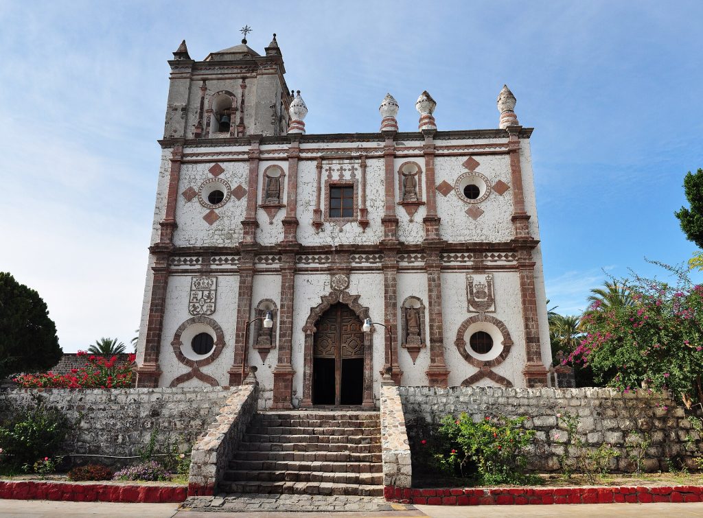
- Stone facade of Mision San Ignacio Kadakaaman (completed 1786) on the San Ignacio plaza. Photo: Gregg M. Erickson (Farwestern Photo), CC BY 3.0, via Wikimedia Commons
- Drone view of Santa Rosalia harbor on the Sea of Cortez. Photo: Eric.Prado, CC BY-SA 4.0, via Wikimedia Commons
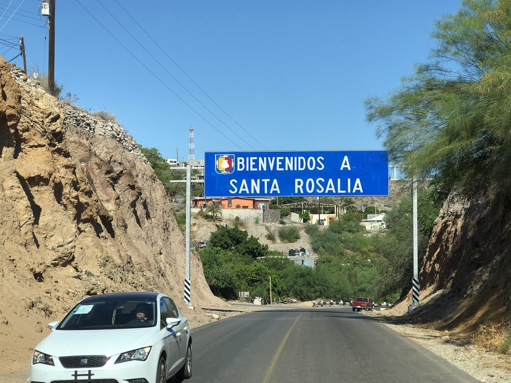
- Entrance sign at Santa Rosalia on Hwy 1. Photo: Purecabo, CC BY-SA 4.0, via Wikimedia Commons
Checked October 22, 2026 against CAPUFE's 2026 toll schedule, the CRE/CNE fuel station registry, OpenStreetMap routing and Google Maps listings. Businesses open, close and change hands; confirm before you go.