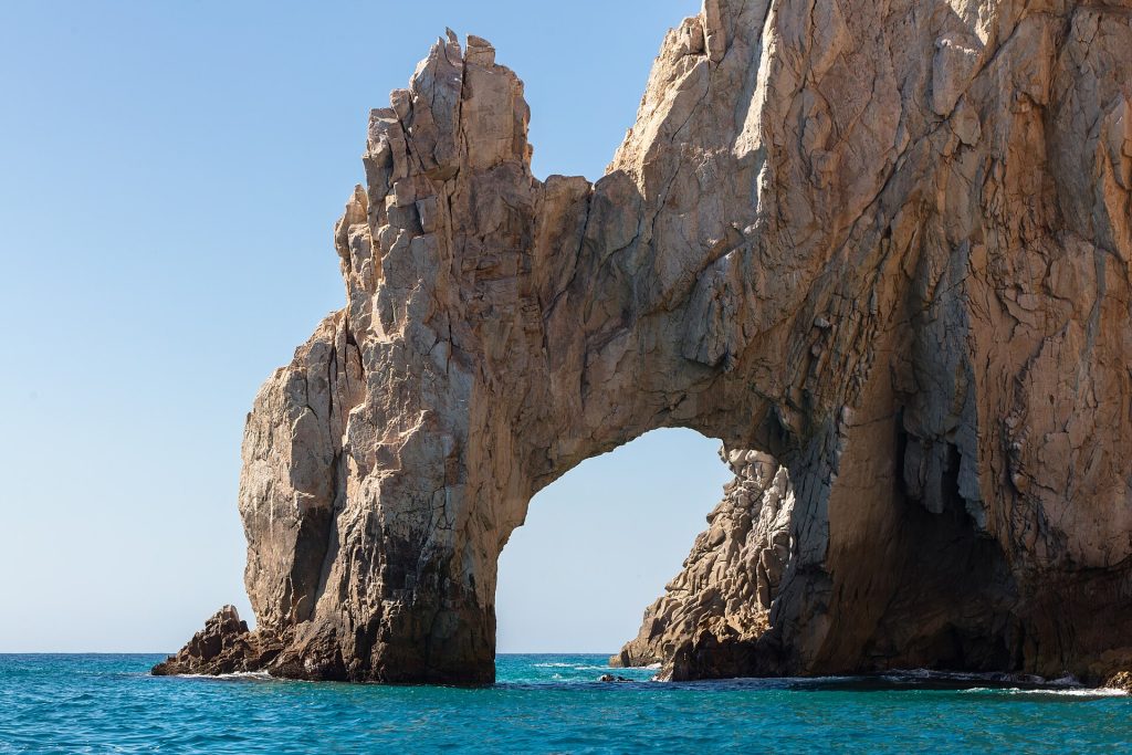
The last stretch: the Tourist Corridor between San José del Cabo and Cabo San Lucas, four lanes past resorts, golf courses and some of the best snorkeling beaches on the cape. The road ends at km 0 by the marina in Cabo San Lucas. You made it.
Route map
Map by Google. Google picks its own fastest line, which can differ from the road log. Open this route in Google Maps to navigate on your phone, and download it for offline use before you lose signal.
The mile log: San José del Cabo to Cabo San Lucas
The original Baja Road Log entries for the Corridor, updated for 2026. Miles count from the light at the San José Centro turnoff. Km posts count down to km 0 in Cabo San Lucas; where the booklet printed a post it is shown, the rest are estimated.
| Mile | Km post | What's there |
|---|---|---|
| 0.0 | ~km 31 | Highway 1 at the light by the turnoff to San José Centro, with a fuel station near the corner. |
| 0.6 | ~km 30 | Light and turnoff into central San José del Cabo on Calle Valerio González. Hotel & Suites Las Palmas is ahead on the right. |
| 1.1 | ~km 29 | Turnoff on Paseo Finisterra. |
| 1.4 | ~km 29 | Turnoff on Paseo de los Cabos to the beachfront hotel zone, including Posada Real Los Cabos. |
| 2.2 | ~km 27 | La Jolla de Los Cabos, now condos. |
| 2.9 | ~km 26 | Ocean-view pullout on the left near Cabo Surf Hotel & Spa, looking over the Sea of Cortez. The beaches below, Playa Costa Azul and Playa Acapulquito, are surf beaches, not for swimming. |
| 3.6 | km 27.5 | Entrance to One&Only Palmilla and its golf club. Use this exit to double back to the ocean-view pullout. |
| 4.9 | ~km 23 | Fuel station with a mini-market. |
| 5.6 | km 22.5 | Entrance to The Westin Los Cabos Resort Villas. El Dorado Golf & Beach Club is half a mile further on the right. |
| 7.8 | km 19.5 | Cabo Real hotel zone, with Paradisus Los Cabos, Las Ventanas al Paraíso (a Rosewood resort) and Zoëtry Casa del Mar Los Cabos. |
| 8.2 | km 18.5 | Dreams Los Cabos Suites Golf Resort & Spa. |
| 9.7 | ~km 15 | Monument to the opening of the four-lane highway between San José del Cabo and Cabo San Lucas in 1993. |
| 11.0 | km 14 | Public access (acceso público) to Bahía Chileno, good for snorkeling and diving. |
| 12.0 | km 12 | Public access to Bahía Santa María: a sand road, then a short walk to a beach popular with swimmers and snorkelers. |
| 13.7 | km 11 | Entrance to Cabo del Sol, with its golf course, Grand Fiesta Americana Los Cabos and Hacienda del Mar Los Cabos. |
| 14.9 | km 9 | Access to Playa Barco Varado (Shipwreck Beach), popular with divers and snorkelers. |
| 17.8 | ~km 2 | Cabo San Lucas Country Club on the right. |
| 18.5 | ~km 1 | Cabo San Lucas, at the junction of Highway 1 with El Bordo (Reforma), which loops around town to Highway 19 and Todos Santos. Straight on for downtown and the marina, where the KM 0 monument marks the end of Highway 1. Turn left for the Old Road to San José del Cabo and Villa del Palmar, and for Playa Médano with Club Cascadas de Baja, Pueblo Bonito Rosé, Pueblo Bonito Blanco, ME Cabo and Hacienda Beach Club & Residences. Médano is the swimming beach closest to downtown. |
Golf course details from the old booklet were dropped; this edition has no golf chapter.
- Toll road or Corridor? The free Corridor (Highway 1) runs past the beaches and resorts with lights and turn lanes. The Los Cabos toll road (1D) runs inland: 93 pesos San José del Cabo to Cabo San Lucas, 118 pesos from the airport, 51 pesos airport to San José del Cabo (CAPUFE rates, April 2026).
- Potholes were reported between the airport and San José del Cabo in October 2026.
- Swimming: many Corridor beaches have strong surf. Chileno and Santa María are the usual snorkeling coves; Médano is the town swimming beach.
- RV parks: the old booklet's Cabo San Lucas RV parks are gone or unlisted. Look near San José del Cabo or on Highway 19.
Fuel
No planning needed: Mexico's registry lists 29 stations in San José del Cabo and 27 in Cabo San Lucas, plus the station near km 5. Find stations on Google Maps: Cabo San Lucas.
Where to stop and stay
Places below showed as operating on Google Maps when we checked on October 22, 2026, under the names they use now. Phone numbers and websites are the ones on their current listings. Call ahead before you count on a room or a campsite.
Tap a name to open it in Google Maps.
The Corridor
- La Jolla de Los Cabos Condos: hotel.
- Cabo Surf Hotel & Spa: hotel, formerly Cabo Surf Royale Hotel. +52 624 142 2676 · Website
- One&Only Palmilla: hotel, formerly Hotel Palmilla. +52 624 146 7000 · Website
- The Westin Los Cabos Resort Villas: hotel, formerly Westin Regina Golf & Beach Resort.
- Paradisus Los Cabos – Adults Only – The Leading Hotels Of The World: hotel, formerly Meliá Cabo Real Beach & Golf Resort.
- Las Ventanas al Paraiso, A Rosewood Resort: hotel, formerly Las Ventanas al Paraíso (Rosewood Hotels). +52 624 144 2800 · Website
- Zoëtry Casa del Mar Los Cabos: hotel, formerly Casa Del Mar Golf Resort & Spa. +52 624 145 7700
- Dreams Los Cabos Suites Golf Resort & Spa: hotel, formerly Meliá Los Cabos. +52 624 145 7600
- Grand Fiesta Americana Los Cabos All Inclusive Golf & Spa.: hotel. +52 800 504 5000 · Website
- Hacienda del Mar Los Cabos, An Autograph Collection All-Inclusive Resort: hotel, formerly Sheraton Hotel Hacienda del Mar.
- Los Cabos Golf Resort: hotel. +52 624 145 7100 · Website
Cabo San Lucas
- Villa Del Palmar Beach Resort & Spa Cabo San Lucas: hotel.
- Pueblo Bonito Rosé Resort & Spa: hotel. +52 624 142 9898 · Website
- Pueblo Bonito Blanco Los Cabos Beach Resort: hotel, formerly Pueblo Bonito Resort.
- ME Cabo by Meliá – Adults Only: hotel, formerly Hotel Meliá San Lucas. +52 554 161 1330 · Website
- Bahia Hotel & Beach House: hotel, formerly Condo Hotel Bahía. +52 624 143 1890 · Website
- Marina Fiesta Resort & Spa: hotel. +52 624 145 6020 · Website
- Marina Cabo Plaza: hotel. +52 624 143 1833 · Website
- Hacienda Beach Club & Residences: hotel, formerly Hotel Hacienda Beach Resort. +52 624 163 3100 · Website
- Seven Crown Express & Suites: hotel, formerly Seven Crown Hotel. +52 624 143 7790 · Website
- Cabo Inn: hotel. +52 624 143 0819 · Website
- Hotel Santa Fe Cabo San Lucas: hotel. +52 624 143 4401 · Website
- Donjuan By Melida Hotel: hotel, formerly Hotel Mélida. +52 624 143 7395 · Website
- Siesta Suites Boutique Hotel: hotel. +52 624 143 2773 · Website
- Capital O Hotel Dos Mares, Cabo San Lucas: hotel. +52 612 980 0503
- Hotel Tesoro: hotel, formerly Plaza Las Glorias Hotel.
- The Bungalows Hotel: hotel, formerly The Bungalows Breakfast Inn. +52 624 125 4426 · Website
- Sandos Finisterra: hotel, formerly Hotel Finisterra. +52 624 145 6700 · Website
- Playa Grande Resort & Grand Spa: hotel. +52 624 145 7500 · Website
- Solmar Resort: hotel, formerly Hotel Solmar.
New since the last booklet
- Grand Velas Los Cabos: resort, Corridor.
- JW Marriott Los Cabos Beach Resort & Spa: resort, near San José del Cabo.
- Hilton Vacation Club Cabo Azul: resort, San José del Cabo.
- Santa María del Cabo: hotel, San José del Cabo.
- Krystal Grand Los Cabos: resort, San José del Cabo.
- Waldorf Astoria Los Cabos Pedregal: resort, Cabo San Lucas.
- Hard Rock Hotel Los Cabos: resort, Cabo San Lucas.
- Casa Dorada Resort & Spa: resort, Médano Beach.
- Medano Hotel and Spa: hotel, Cabo San Lucas.
- Nobu Hotel Los Cabos: resort, Cabo San Lucas.
What changed from the old booklet
| Mile | Change |
|---|---|
| 0.6 | Plaza Las Palmas and its cinemas were not confirmed. |
| 1.1 | Howard Johnson Plaza Suites could not be found, and the old San José golf course was not confirmed. |
| 1.4 | "Best Western" dropped from Posada Real (Hal's edit, confirmed). Fiesta Inn, Tanimara and Palmita could not be found; the Presidente Inter-Continental is permanently closed. |
| 1.9 | Brisa del Mar RV Resort could not be found. |
| 2.2 | Renamed La Jolla de Los Cabos Condos. |
| 2.9 | Cabo Surf Royale is now Cabo Surf Hotel & Spa. |
| 3.6 | Hotel Palmilla is now One&Only Palmilla. |
| 5.6 | Westin Regina renamed; El Dorado course renamed. |
| 7.8 | Meliá Cabo Real became Paradisus Los Cabos in 2016. Casa del Mar is now Zoëtry Casa del Mar (Hal's edit, confirmed). The Cabo Real golf course is listed as permanently closed. |
| 8.2 | Meliá Los Cabos is now Dreams Los Cabos. |
| 10.6 | Hotel Cabo San Lucas could not be found. |
| 12.7 | Hotel Twin Dolphin is gone; only the private Twin Dolphin Club remains. |
| 13.7 | Fiesta Americana and Sheraton Hacienda del Mar renamed. The "under construction" course note dropped. |
| 15.9 | Calinda Beach Hotel is permanently closed, and Misiones del Cabo now appears only as condo rentals. |
| 16.6 | El Arco Trailer Park could not be found. |
| 17.2 | Cabo Cielo RV Park could not be found. |
| 17.8 | Vagabundos del Mar RV Park is permanently closed. |
| 18.5 | Meliá San Lucas is now ME Cabo. Pueblo Bonito and Hacienda Beach renamed. Club Cabo is listed as temporarily closed. |
Related guides
- Mexican car insurance for tourists
- Rental car insurance in Mexico
- Toll roads vs free roads in Baja
- Money tips for a Baja road trip
- The Baja Road Log: all 12 legs
Pick the exact days you will be in Mexico, including the drive back north. Get a Mexican auto insurance quote online in minutes.
Frequently asked questions
Should I take the toll road or the free road between San José del Cabo and Cabo San Lucas?
The free Corridor (Highway 1) is the scenic way, past the beaches and resorts. The Los Cabos toll road (1D) runs inland and is quicker at busy times, for 93 pesos from San José del Cabo or 118 pesos from the airport.
How much is the Los Cabos toll road?
For a car: 93 pesos San José del Cabo to Cabo San Lucas, 118 pesos from the airport to Cabo San Lucas and 51 pesos from the airport to San José del Cabo, under the CAPUFE rates in effect since April 13, 2026.
How far is San José del Cabo from Cabo San Lucas?
About 20 miles (32 km), or 30 to 45 minutes on the Corridor.
Photo credits
- El Arco at Land's End, Cabo San Lucas. Photo: Diego Delso, CC BY-SA 4.0, via Wikimedia Commons
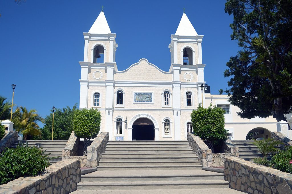
- Mission church on the plaza in central San Jose del Cabo. Photo: Thelmadatter, CC BY-SA 4.0, via Wikimedia Commons
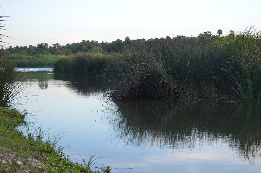
- San Jose del Cabo estuary, a protected wetland at the river mouth. Photo: Thelmadatter, CC BY-SA 4.0, via Wikimedia Commons
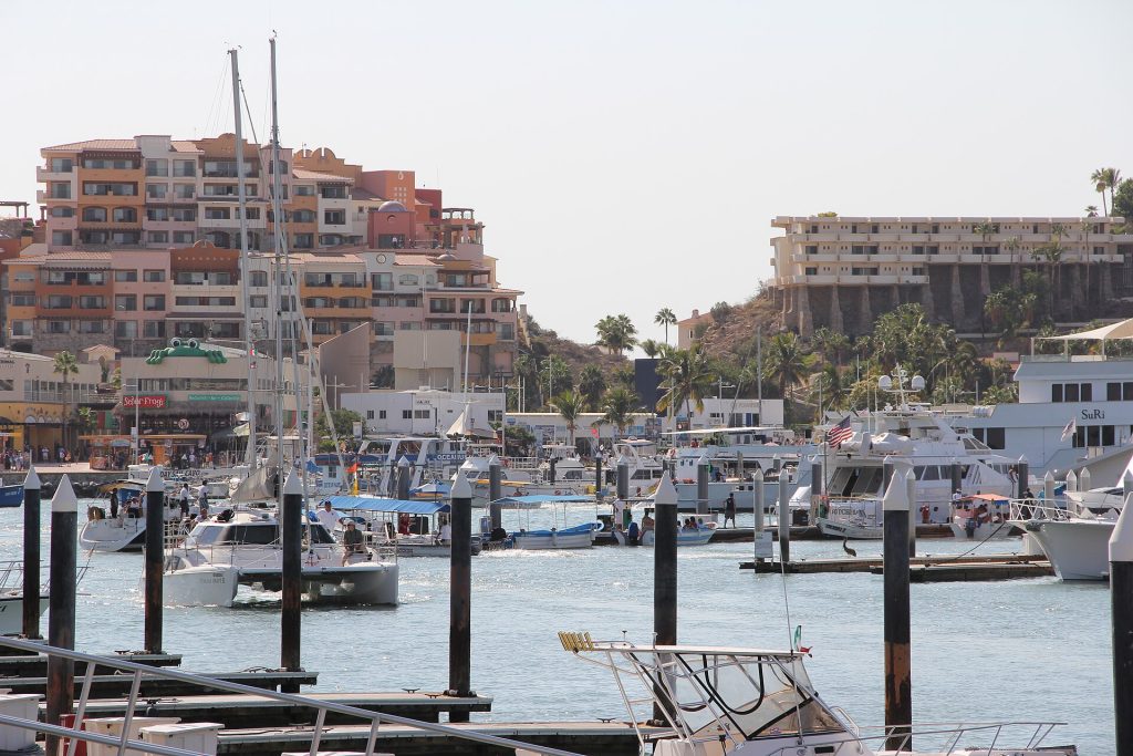
- Cabo San Lucas marina. Photo: Clemens Vasters from Viersen, Germany, CC BY 2.0, via Wikimedia Commons
Checked October 22, 2026 against CAPUFE's 2026 toll schedule, the CRE/CNE fuel station registry, OpenStreetMap routing and Google Maps listings. Businesses open, close and change hands; confirm before you go.