


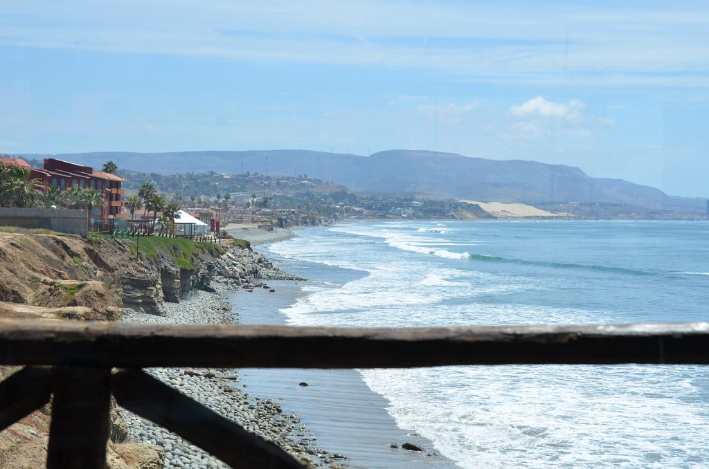
This is the prettiest hour of the whole trip. The Scenic Road (Mexico 1-D) runs along the cliffs above the Pacific from Rosarito, past Puerto Nuevo and La Misión, then climbs over the headlands at Salsipuedes before it drops into El Sauzal and the port of Ensenada. Two toll booths, plenty of fuel, and a lot of places to pull off for lobster or a view.
Route map
Map by Google. Google picks its own fastest line, which can differ from the road log. Open this route in Google Maps to navigate on your phone, and download it for offline use before you lose signal.
The mile log: Rosarito to Ensenada
The original Baja Road Log entries, updated for 2026. Miles count from the Rosarito toll booth. The km column is the nearest toll-road post, estimated from the booths at km 36.6 and km 99; posts the booklet printed itself match within a few hundred meters.
| Mile | Km post | What's there |
|---|---|---|
| 0.0 | ~km 37 | Rosarito toll booth (CAPUFE booth No. 35). Cars pay 49 pesos for the section to La Misión. |
| 2.9 | ~km 41 | Baja Studios, the old Fox Studios Baja where Titanic was filmed, beside the road. It is a working film studio again. |
| 8.9 | ~km 51 | Calafia/Puerto Nuevo exit to the free road. To the north: Hacienda Rancho Santini, Las Rocas Resort and Spa and Hotel Calafia. To the south: Puerto Nuevo Baja Hotel y Villas and the Puerto Nuevo lobster village, a street of restaurants serving fried Pacific lobster with beans, rice and tortillas. |
| 11.5 | ~km 55 | Cantamar/Puerto Nuevo exit to the free road, with restaurants and stores. |
| 15.0 | ~km 61 | Cuenca Lechera exit to the free road and the Half Way House (Medio Camino) restaurant and bar, opened in 1922 as a stop halfway between Tijuana and Ensenada. |
| 18.0 | ~km 66 | La Misión/Plaza del Mar exit (also called Alisitos) for Dmytri's Original La Fonda and Hotel La Misión. Take the free road south to the ruins of Misión San Miguel Arcángel de la Frontera, the Dominican mission founded in 1787, next to the primary school at km 65.5 of the free road. The free road then winds inland and rejoins Highway 1 just south of the Ensenada toll booth. |
| 19.9 | ~km 69 | Rest area (área de descanso) with a wide sandy beach and parking. |
| 22.1 | ~km 72 | Baja Seasons Resort & RV Park at km 72. |
| 22.5 | ~km 73 | La Salina exit for the La Salina beach community and the Puerto Salina marina. |
| 25.4 | ~km 77 | Bajamar/Jatay exit at km 77.5 for the Bajamar Ocean Front Golf Resort and Hotel Hacienda Bajamar. |
| 29.4 | ~km 84 | El Mirador viewpoint. Careful: a sharp curve follows. |
| 30.4 | ~km 86 | Rest stop with parking. |
| 31.8 | ~km 88 | Salsipuedes exit. Salsipuedes means "get out if you can", a fair warning about the steep, rocky road down to the bay. Not for RVs. |
| 35.1 | ~km 93 | Around km 93: the section that sank on December 28, 2013. It was rebuilt within about a year, but slides have closed it since. After heavy rain, check road reports before you set out. |
| 35.9 | ~km 94 | Turnoff to Playa Saldamando, with beach camping (southbound exit only), at km 94. |
| 36.1 | ~km 95 | Rest area and whale-watching viewpoint. |
| 39.0 | ~km 99 | Ensenada toll booth (San Miguel) at km 99. Cars pay 53 pesos. Exit just south for Villa de San Miguel and the surf break at Playa San Miguel. The junction with the free road to Tijuana is just ahead. |
| 40.7 | ~km 102 | Junction with Highway 3 to Tecate (64 miles). Highway 3 runs through the vineyards of San Antonio de las Minas (7 miles) and Valle de Guadalupe (17 miles), Mexico's best-known wine country. |
| 40.8 | ~km 102 | El Sauzal de Rodríguez, a fishing port with a harbor, canneries, stores, a llantera (tire shop) and fuel. |
| 43.5 | ~km 107 | Hotel Las Rosas & Spa, with its pool on the edge of the Pacific. |
| 43.8 | ~km 107 | Propane (L.P. gas) depot on the left. |
| 44.1 | ~km 108 | Turnoffs on the right to Punta Morro and the Universidad Autónoma de Baja California (UABC) campus. |
| 44.4 | ~km 108 | Road forks. Keep right on Blvd. Costero along the coast for Hotel Coral y Marina, Quintas Papagayo, the harbor, downtown and the way to San Quintín. The left fork skips downtown on Calles 10 and 9 to Av. Reforma, which runs south past the Benito Juárez monument and becomes Highway 1. For San Felipe, turn east on Calzada Cortez to Highway 3. |
| 46.1 | ~km 111 | The coastal route forks again; keep left. The right fork (Recinto Portuario) goes into the commercial harbor. |
| 46.7 | ~km 112 | Ensenada, at boulevards Azueta and Costero (also called Lázaro Cárdenas). Carry straight on for the big open-air fish market and the malecón along the bay. |
| 46.9 | ~km 112 | Another entrance to the fish market. |
| 47.0 | ~km 112 | Plaza Cívica, better known as the Plaza de las Tres Cabezas for its giant heads of Benito Juárez, Miguel Hidalgo and Venustiano Carranza. |
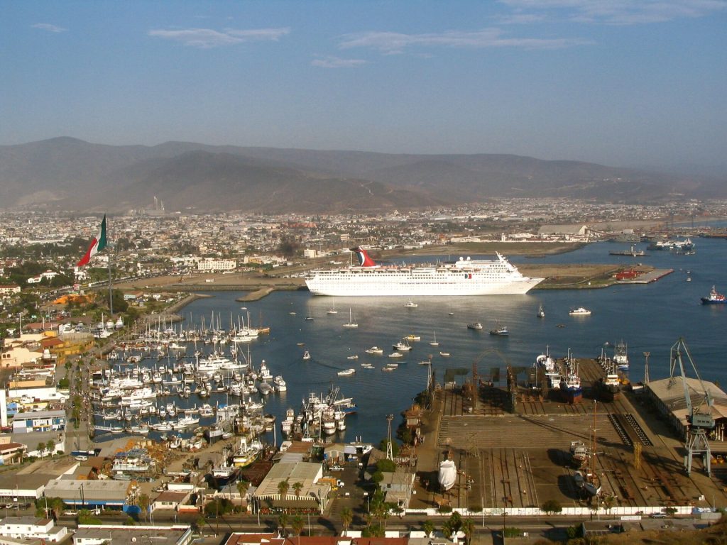
| 47.2 | ~km 113 | Parque Ventana al Mar and its giant Mexican flag. |
| 47.4 | ~km 113 | Cross the bridge. Ensenada Cruiseport Village and the cruise ship terminal are on the right; the Centro Cultural Riviera, the old Riviera del Pacífico, is on the left. |
| 48.0 | ~km 114 | Turn left where Blvd. Costero meets Av. Sangines, which leads to Highway 1 south. Straight on, signs lead to the Libramiento bypass toward Highway 3 and San Felipe. |
| 48.6 | ~km 115 | Av. Sangines meets Highway 1 (Av. Reforma). Leg 3 starts here. |
Two lines in the old booklet were pasted over and cannot be read; they are left out.
- Tolls: Rosarito booth 49 pesos and Ensenada (San Miguel) booth 53 pesos for a car, CAPUFE rates in effect since April 13, 2026. The Nodo Popotla booth (45 pesos) applies only if you join the toll road from the Corredor 2000 road. Pay in pesos.
- Km 93: the slide-prone stretch near Salsipuedes. If it has rained hard, check road reports before you leave.
- Storm Rachel: around October 10 to 11, 2026, flooding hit parts of Ensenada. As of October 22 we found no report of the Scenic Road or Highway 1 still closed; a bridge in the area (Puente Oaxaca) is being rebuilt with traffic on alternate streets (El Imparcial, Oct. 19). Check before you go: road alerts from SICT and CAPUFE, ask at your hotel, or call 078 (24-hour tourist assistance). Never drive into moving water at an arroyo crossing.
- Fog: sea fog is common on the headlands. Slow down and keep your lights on.
The free road (Libre) alternative
Mexico 1 Libre runs beside the toll road along the coast from Rosarito through Puerto Nuevo to La Misión, then turns inland through the hills and rejoins the main road just south of the Ensenada toll booth. It is free and it is the road you want for Puerto Nuevo, Calafia, Las Rocas and the La Misión mission ruins. It is slower, with topes and town traffic, and the full run is about 51 miles. Many drivers use the free road for the stops near Rosarito and get back on the toll road at La Misión.
Fuel
Plenty of stations on this leg: two at Puerto Nuevo (one at about km 44.5 on the free road), one at La Misión, seven in El Sauzal and more than 30 in Ensenada, according to Mexico's station registry. This is the last stretch where you never have to think about it. Find stations on Google Maps: Puerto Nuevo, El Sauzal, Ensenada.
Where to stop and stay
Places below showed as operating on Google Maps when we checked on October 22, 2026, under the names they use now. Phone numbers and websites are the ones on their current listings. Call ahead before you count on a room or a campsite.
Tap a name to open it in Google Maps.
Puerto Nuevo
- Puerto Nuevo Baja Hotel y Villas: hotel, formerly New Port Beach Hotel. +52 661 614 8900 · Website
La Misión
- Hotel La Mision: hotel. +52 646 155 0333 · Website
- Dmytri's Original La Fonda: hotel, formerly Hotel La Fonda. +52 646 155 0872
- Alisitos Sandy Beach K58 Camping: RV park or campground, formerly Alisitos Trailer Park Ejidal.
La Salina
North of the Ensenada toll booth
- Hotel Hacienda Bajamar: hotel. +52 646 155 0151 · Website
- Playa Saldamando: campground. +52 646 118 5974
Ensenada, north of town
- Hotel Sausalito: hotel. +52 646 174 6145 · Website
- California Trailer Park & Hotel: RV park or campground. +52 646 174 6033 · Website
- Ramona Rv Park: RV park or campground. +52 646 121 0071
- Hotel Las Rosas & Spa: hotel. +52 646 174 4310 · Website
- Punta Morro: hotel. +52 646 178 3507 · Website
- Hotel Coral Y Marina: hotel. +52 646 175 0000 · Website
- Quintas Papagayo: hotel.
Ensenada, central
- Hotel Ritz: hotel. +52 646 174 0502
- Hotel del Valle: hotel. +52 646 178 2224 · Website
- Hotel Bahia: hotel. +52 646 178 2101 · Website
- Hotel VillaFontana Inn: hotel, formerly Days Inn Hotel Villa Fontana. +52 646 178 3434 · Website
- Best Western El Cid: hotel. +52 646 178 2401 · Website
- Hotel Villa Marina: hotel. +52 646 178 3321 · Website
- Americas Best Value Inn – Posada El Rey Sol: hotel. +52 646 178 1601 · Website
- Hotel Casa Del Sol: hotel, formerly Best Western Motel Casa del Sol. +52 646 178 1570
- Hotel Misión Santa Isabel: hotel. +52 646 178 3616 · Website
- Hotel Cortez: hotel, formerly Baja Inn Hotel Cortez.
- Corona Hotel & Spa: hotel. +52 646 176 0901 · Website
- Hotel La Pinta: hotel. +52 646 176 2601 · Website
- San Nicolas Hotel & Casino: hotel, formerly San Nicolás Resort Hotel & Convention Center. +52 646 176 1901 · Website
- Motel Colón: motel. +52 646 176 1910 · Website
- Rudis Motel: hotel.
- Hotel Presidente: hotel. +52 646 176 1476 · Website
- Hotel Suites Malena: hotel. +52 646 176 4180 · Website
- Las Dunas Hotel: hotel. +52 646 176 2771 · Website
- Hotel Paraiso Las Palmas: hotel. +52 646 177 1701 · Website
- Campo Playa RV Park: RV and mobile home park.
New since the last booklet
- Hacienda Rancho Santini: bed and breakfast near km 40 on the free road.
- Clam Beach RV Park: RV park at km 70 on the Scenic Road.
- Poco Cielo: hotel near La Misión.
- Torre Lucerna Hotel Ensenada: hotel.
- Marea Vista Hotel: hotel, Ensenada.
- City Express by Marriott Ensenada: hotel.
- Costa Carel R.V. Park: RV park, Ensenada.
- El Valle RV Park: RV park, Ensenada.
What changed from the old booklet
| Mile | Change |
|---|---|
| 0.0 | Booklet listed restrooms and mini-markets at the booth. Not confirmed for 2026, so dropped. |
| 2.9 | Fox Studios Baja is now Baja Studios. |
| 8.9 | Giorgio Santini Gallery is now Hacienda Rancho Santini (B&B). New Port Beach Hotel is now Puerto Nuevo Baja Hotel y Villas. Grand Baja Resort could not be found and was removed. |
| 15.0 | Name updated to Half Way House / Medio Camino. |
| 18.0 | La Fonda is now Dmytri's Original La Fonda. Pyramid Resort could not be found and was removed. The May fiesta date was not confirmed for 2026 and was dropped. |
| 22.1 | Name updated to Baja Seasons Resort & RV Park. |
| 22.5 | La Salina Bar/Restaurant/Motel could not be found and was removed. |
| 25.4 | Golf course details dropped (no golf chapter in this edition). |
| 29.4 | "No services" note dropped. |
| 31.8 | Rancho Salsipuedes campground could not be found and was removed. |
| 35.1 | Added: the km 93 slide zone. |
| 39.0 | Restrooms, the RV park and the surf contest note were not confirmed for 2026 and were dropped. |
| 43.5 | Name updated to Hotel Las Rosas & Spa. |
| 44.1 | Punta Morro Resort now listed as Punta Morro. |
| 44.4 | Directions kept; hotel names updated. |
| 46.7 | Immigration office and tourism bureau directions dropped (not confirmed at the old addresses). |
| 47.0 | Current name added. |
| 47.2 | Flagpole height dropped (not confirmed). |
| 47.4 | Cruiseport is finished (the booklet said under construction). State tourism office dropped. |
| 48.6 | Gigante supermarkets are gone (the chain was sold to Soriana in 2007). |
Related guides
- San Diego to Ensenada road trip
- Puerto Nuevo lobster day trip
- Valle de Guadalupe wine country
- Toll roads vs free roads in Baja
- The Baja Road Log: all 12 legs
Mexican auto insurance is required on the Scenic Road and every federal highway in Baja. Get a quote online in minutes.
Frequently asked questions
How much are the Tijuana to Ensenada tolls in 2026?
152 pesos for a car (about $8.20) across three booths: Playas de Tijuana 50, Rosarito 49 and Ensenada (San Miguel) 53, under the CAPUFE rates in effect since April 13, 2026. From Rosarito to Ensenada you pay the last two, 102 pesos.
Is the Scenic Road open at km 93?
The section near Salsipuedes that sank in December 2013 was rebuilt, but slides have closed the area since. It is the one stretch to check after heavy rain. If it is closed, the free road through La Misión gets you to Ensenada.
How long is the drive from Rosarito to Ensenada?
About 51 miles (82 km), or 1 to 1.5 hours, depending on stops and traffic in Ensenada.
Can I take the free road from Rosarito to Ensenada?
Yes. Mexico 1 Libre runs along the coast to La Misión, then inland to rejoin Highway 1 south of the Ensenada toll booth. It is free but slower, with topes and town traffic.
Photo credits
- Pedestrian bridge spanning the parallel free and toll highways along the northern Baja. Photo: Chris Hunkeler from Carlsbad, California, USA, CC BY-SA 2.0, via Wikimedia Commons
- Puerto Nuevo, the lobster village on the Rosarito-Ensenada coast, 2015. Photo: Rob Bertholf from San Diego, CA, USA, CC BY 2.0, via Wikimedia Commons
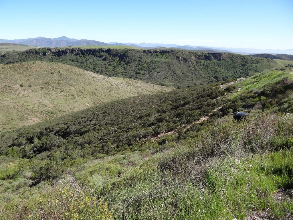
- Coastal scenery photographed en route to Ensenada, 2012. Photo: Adam Jones from Kelowna, BC, Canada, CC BY-SA 2.0, via Wikimedia Commons
- The port of Ensenada at early morning, 2006. Photo: cesar bojorquez from Tijuana, Mexico, CC BY 2.0, via Wikimedia Commons
Checked October 22, 2026 against CAPUFE's 2026 toll schedule, the CRE/CNE fuel station registry, OpenStreetMap routing and Google Maps listings. Businesses open, close and change hands; confirm before you go.